


One crisis. Many faces.
Climate change isn't a single event you can plan for. The same warming atmosphere that drives a flash flood this month deepens a drought the next — and makes the weather in between harder to predict every year. Too much water. Too little water. At the wrong time, in the wrong place.
Too little water
Drought & water scarcity
The balance we've lost.
Too much water
Floods & flash floods
Climate change doesn't reach us as temperature. It reaches us as water.
When we talk about climate change, we usually talk about temperature. But temperature floods nobody's cellar, dries no field and empties no reservoir. Warming reaches people, towns and the infrastructure they depend on almost entirely through water — as floods that arrive too fast, droughts that linger too long, storms that hit too hard, and the slow, steady failing of the water we drink and grow our food with.
A warmer atmosphere does both at once: it drops a heavier downpour, then dries the land faster between two of them — so what changes isn't how much water falls, but how unevenly it arrives. And these are the hardest events to see: they form on an unnamed stream with no gauge, under a cell that fits between the two nearest measuring points. That's why Meratch exists — to measure where the data doesn't yet.
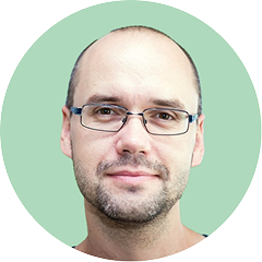
Jozef Pecho
Climate/NWP Model & Data Analyst

Floods
Flash floods and overflow arrive faster and hit harder than legacy warning systems can detect.

Droughts
Soil dries out and water runs short — threatening crops, supply and raising wildfire risk.

Storms
Rainfall, storms and heat swing to extremes the historical record no longer predicts.

Water Quality
Sediment and microbes, drought, heat strips out oxygen. And it shows up hours later.
These aren't four separate problems. They're symptoms of one crisis — and they demand one response.
One connected platform for climate adaptation.
Three earth sciences — hydrology, meteorology and climatology — on a single hyperlocal platform. Meratch owns the whole chain, from sensor in the ground to AI-driven forecast on your screen.
Flash Flood Early Warning
Floodar is a flash flood early warning system that gives municipalities, river basin authorities, and critical infrastructure operators the time they need to act — issuing alerts before water rises, so response is measured in hours, not minutes.
Weather Nowcasting
Meratch's extreme weather forecasting engine delivers hyperlocal forecasts of severe weather from the next few hours to several days ahead, with a special focus on the nowcasting window — the critical time frame where traditional forecasts fall short.
Drought Early Warning
Flash droughts strike fast — developing in weeks instead of months as heatwaves and rainfall deficits rapidly deplete soil moisture. Drought gives water managers and farmers early warning, so they can prepare before wells run low and crops fail.
Water Quality Monitoring
AquaSensio is an autonomous water quality monitoring system designed for continuous, in-situ measurement in wells, boreholes, rivers, and reservoirs — even in remote locations with minimal maintenance, flagging contamination the moment readings drift from the safe range.

The blind spot.
Regional forecasts miss the street, the field and the catchment where decisions are made.
National forecasts and warnings are good — they're just not close enough. It isn't a question of quality, but of scale. The weather that matters happens at a single point: this substation, this plant intake, this stretch of road, this field. But a storm cell is only a few kilometres wide and lasts tens of minutes, while the public sensor network measures every few tens of kilometres — and a network can't resolve anything smaller than the spacing between its points. An area-wide forecast can't tell apart two places three kilometres apart — even when one is hit and the other stays clear.
And the gap is widening. A warming climate doesn't only make extremes stronger — it also changes how they are distributed in space. As dew points rise, a growing share of heavy rainfall is taking on a convective rather than stratiform character: short, violent, and concentrated in cells just a few kilometres across, instead of spread evenly across a region. Sub-hourly downpours are intensifying the fastest of all. In practice, this means the events causing the most damage are becoming exactly the events a coarse regional grid cannot see.

Events a coarse regional grid cannot see
Which is why area-wide warnings are losing their audience. A warning is issued for a whole district; the storm hits one village inside it. For everyone else it registers as another false alarm. In our survey among Slovak mayors, most said they no longer rely on district-level warnings for their own decisions — not because the warnings are wrong, but because they are not specific enough to be actionable. Every false positive costs a little credibility, until the one alert that really matters is the one nobody moves on. And once that trust is gone, a better forecast alone won't bring it back — it returns only when a warning finally means something at the exact place it was sent to.
Weather made to measure
Meratch closes the gap. Instead of country-wide weather, it gives you the weather where you actually operate. Smart IoT sensors monitor rainfall, water level, wind and related parameters directly on site; data is evaluated in real time, and when preset thresholds are crossed the system automatically alerts the people responsible.
Because the trigger is your own measurement — not an average over a district — an alert means something is happening to you. That is what makes it worth acting on. Meratch doesn't replace national warnings; it adds the hyperlocal layer that ordinary forecasts routinely miss, and turns "somewhere in the region, sometime today" into "here, now, this much."
End-to-end,
one company.

Sensors
LoRa, NB-IoT, 2G, and satellite connectivity options ensure data transfer even during the worst floods, when infrastructure is failing.

Real-time data
High-quality electronics and advanced post-processing ensure reliable flood warnings. We flag suspicious data and adjust system predictions.

Edge & cloud computing
Intuitive online dashboard and mobile app to view and understand sensor data is part of the Floodar package at no additional cost.

Hyperlocal forecast
Durable sensors withstand harsh flood conditions. Plug & play design with installation hardware for easy setup.

Bulletproof connectivity
99.8% uptime

Seal of Excellence

AI models
Behind every alert is a real scientist.
Meratch isn't a black box. Our hydrological, meteorological and climatological models are built and validated by working scientists — the same expertise national agencies rely on.
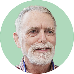
Peter Gabris
Hydrologist
Peter is a senior computational hydrologist and co-author of multiple flood forecasting systems for large river basins. At Meratch, he brings years of proven expertise in operational flood prediction.
Jozef Pecho
Climate Analyst
Jozef has strong expertise in climate analysis and the evaluation of climate risks and extremes. At Meratch, he turns climate data into actionable insights for hydroclimatic monitoring and forecasting.

Miroslav Singer
Meteorologist
Miroslav has expertise in weather analysis, forecasting, and meteorological tool enhancement, with a focus on local severe weather. At Meratch, he develops and evaluates nowcasting weather models for short-term forecasting.
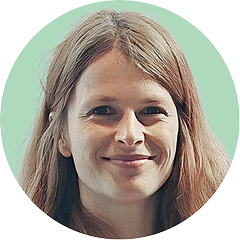
Viera Rattayova
Data Scientist in Hydroclimatology
Viera is a hydroclimatology scientist focused on data science, remote sensing, and applying AI algorithms to hydroclimatological modeling. At Meratch, she designs the methodology and workflows for hydrological modeling.
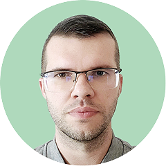
Vladimir Chudoba
GIS Expert
Vladimir has a GIS background from research work on water systems and hydrological modeling. At Meratch, he builds spatial data workflows and geospatial analyses that underpin modeling and risk evaluation.

Ondrej Zavodsky
HW Lead Engineer
Ondrej has a hardware engineering background from research on IoT electronic device design. At Meratch, he develops low-power IoT architectures and microcontroller workflows, including work on the skCUBE satellite project.

Milan Onderka
Hydrologist & Climatologist
Milan has expertise in hydrology and climatology, focusing on meteorological and precipitation extremes. At Meratch, he analyses and interprets extreme precipitation events to support robust hydroclimatic monitoring and modelling tools.
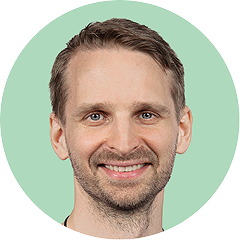
Tomas Zvolensky
Business Development Manager
Tomas has a background in wireless technologies, marketing, and business development. At Meratch, he helps customers scope the specifics of their wireless sensing projects and guides their buying journey.
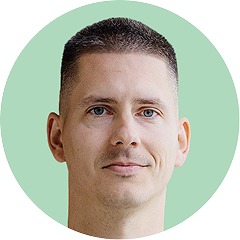
Stefan Kadlic
Software Development
Stefan is head of the software department, driving technical direction across Meratch projects. He works closely with hardware and science teams to deliver dependable systems for monitoring, analytics, and forecasting.
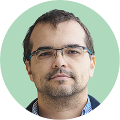
Alexander Kutka
Project Manager
Alexander is an experienced project manager focused on implementing EOS — the Entrepreneurial Operating System, a world-renowned management framework that helps leadership teams gain control, improve efficiency, and drive growth.
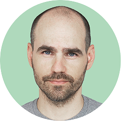
Pavol Turcina
CEO
Pavol is a serial entrepreneur building strategic partnerships across telecommunications, M2M, and IoT. At Meratch, he leads teams delivering wins in smart cities, environmental monitoring, meteorology, and flood-prevention technology.

Real deployments. Real institutions.
Monitoring groundwater levels is our obligation at CHMI, and getting it right matters – the data feeds into national drought monitoring, hydrological balance assessments, and public reports and maps on groundwater across the Czech Republic.

The deployment of these smart sensors enables us to monitor water levels, soil conditions and atmospheric factors in real time, providing crucial data for flood prediction and prevention. Early warning is crucial for emergency services to act quickly and manage the risks.

